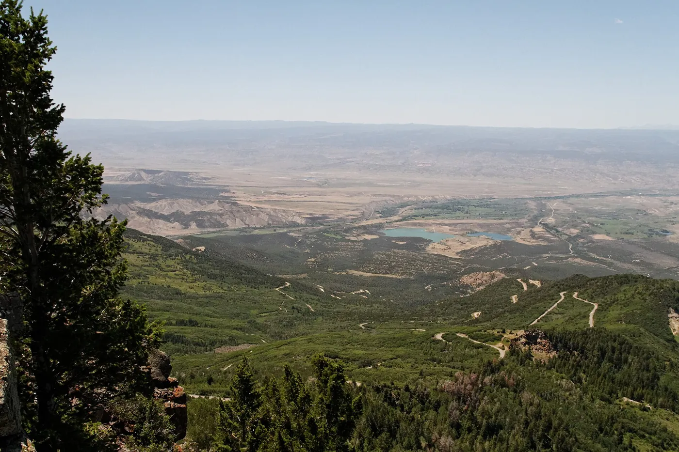
Grand Mesa gives the Grand Valley a broad, high horizon. From below, the outline can suggest something permanent: a level top held above the surrounding country. Its geological story is almost the reverse. Ancient lava occupied low ground; erosion and changing drainage helped turn the surviving rock into high ground. Later ice, slope movement, snow, forests, and water management added other layers. The mesa is best understood as a changing landscape whose geological inheritance still shapes life in the valley.
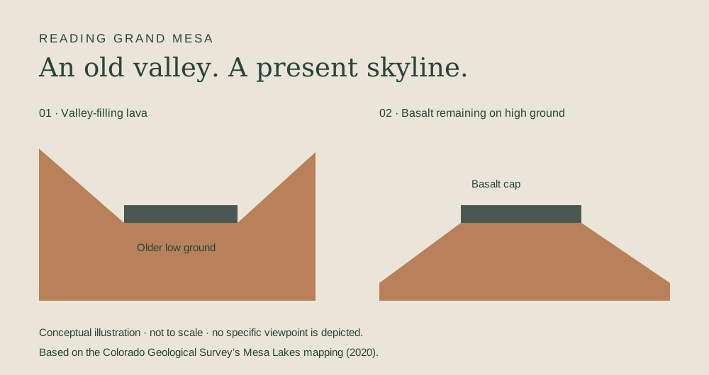
The low place that became high ground
The Colorado Geological Survey describes Grand Mesa as an example of topographic inversion. In the Mesa Lakes quadrangle account, approximately ten-million-year-old basalt flows that filled an older valley now occupy the divide between the Colorado and Gunnison river systems. A former low place survives as high ground relative to terrain eroded around it.
Inversion is a relationship between landscapes at different times. It does not mean that a valley was physically flipped upside down. Material deposited in low ground can resist erosion differently from its surroundings. As the surrounding country is lowered, a resistant remnant may become prominent. The present skyline can therefore preserve evidence of a landscape whose original relief was very different.
That is the central surprise of Grand Mesa. A flat-looking summit does not necessarily represent a surface that was always high. Its history has to be reconstructed from the rocks and their relationships. The view is the result to be explained, not a diagram showing the starting conditions.
Source notes: Colorado Geological Survey: Mesa Lakes Quadrangle OF-19-08 ↗
Basalt is a clue to process
Basalt is volcanic rock: the product of lava cooling at or near the surface. A basalt-capped mesa is not simply a sandstone plateau with a darker top. Its materials record an episode of volcanism before later erosion shaped the surviving landform. That makes it a different geological subject from the ancient dune sandstone so prominent across the valley at Colorado National Monument.
Rex D. Cole's contribution to a USGS-hosted workshop report describes a sequence of basalt flows, variation in their preserved thickness, and remnants beyond the main cap. That account is important for its picture of multiple events and incomplete survival. It is less useful as a pretext for assigning one exact birthday to an entire mountain.
The geological record is sampled and interpreted. A dated rock specimen constrains a particular material or event; it does not automatically date every neighboring surface. For a regional explanation, “roughly ten million years” conveys the scale of the volcanic episode more honestly than an apparently exact age stripped of its sampling context. The approximate expression is a deliberate choice, not a gap filled by guesswork.
Source notes: USGS OFR 2011–1210, Cole: Grand Mesa Basalt Field ↗
The cap is a remnant, not the whole original field
Cole's account describes surviving lobes and outlying remnants of the basalt field. It also discusses the possibility that the original volcanic extent was substantially larger than the area preserved today. This is another reason a modern outline should not be treated as the edge of the ancient lava landscape.
Erosion removes evidence as well as revealing it. Geologists work from what survives: remnants, contacts, landforms, and the relationships between them. A reconstruction becomes stronger when those pieces agree, but the absence of rock at a place today does not necessarily show that it was never present there.
For a reader, the practical distinction is between a mapped present distribution and an interpreted earlier extent. Both can be useful; they answer different questions. A simple explanatory diagram should make that distinction clear and identify itself as conceptual. It should not turn a few stylized arrows into a surveyed map or show precise ancient river courses that the evidence does not establish.
Source notes: USGS OFR 2011–1210, Cole: Grand Mesa Basalt Field ↗
“Flat-topped” does not mean featureless
The Mesa Lakes account describes basalt, glacial deposits, and associated landforms across the mapped upper surface. The broad silhouette therefore conceals smaller variations that matter on the ground. A horizon can look level from a valley while the terrain above contains ridges, depressions, exposed rock, and deposits left by later processes.
The word “mesa” helps describe a landform; it does not promise a perfectly horizontal tabletop. Nor does it define one universal summit elevation. Different reference points and boundaries answer different measurement questions. It is more useful to name a specific point when an elevation matters than to treat a broad landscape as though it had one height.
The same caution applies to the familiar claim that Grand Mesa is the world's largest flat-topped mountain. Agencies and visitor materials use variations of that description, but the comparison depends on definitions and boundaries. This feature does not need the record claim. Its educational value lies in the processes and relationships that can be explained without winning a global size contest.
Source notes: Colorado Geological Survey: Mesa Lakes Quadrangle OF-19-08 ↗ · USGS OFR 2011–1210, Cole: Grand Mesa Basalt Field ↗
Ice and gravity added to the volcanic inheritance
The Mesa Lakes mapping identifies glacial deposits on the upper surface and mass-wasting deposits around the rim slopes. Those are different processes. Glaciers involve moving ice and the erosion and deposition associated with it. Mass wasting concerns the movement of rock and soil downslope under gravity. Their deposits can coexist without sharing one origin or one date.
This is why “lava made Grand Mesa” is an incomplete explanation even when it captures an important beginning. The volcanic cap was subsequently modified within a landscape affected by drainage change, ice, erosion, and slope movement. The landform has a sequence of histories rather than a single forming event.
These are regional geological observations, not a site-specific safety assessment. A mapped landslide deposit does not tell a visitor that every adjacent trail is unstable today, and a calm-looking slope is not proof of safety. Describing the history responsibly means preserving that distinction. Current travel decisions require the relevant land manager's information and, where needed, professional assessment.
Source notes: Colorado Geological Survey: Mesa Lakes Quadrangle OF-19-08 ↗
Lakes need individual histories
The abundance of water features is central to the way people encounter Grand Mesa. But a lake seen beside a road is not self-explanatory. Its basin, inflow, outlet, and any constructed works belong to its particular history. Glacial deposits in a mapped area do not establish that every visible lake was excavated by a glacier. A regional reservoir system does not establish that every lake supplies the same users.
The city's Water Supply page makes the engineered part of this landscape explicit. It describes operating and maintaining reservoirs on Grand Mesa and conveying raw water through flowlines. A body of water can be visually appealing and also participate in a managed system whose purpose extends far beyond the shore.
A careful field guide should name the water feature, establish its natural and constructed history, and identify its management context before making claims about origin or use. That work is more demanding than attaching the same glacial-lake caption to every photograph. It also yields a better story: geology creates possibilities, while communities decide how some of those possibilities are used.
Source notes: Colorado Geological Survey: Mesa Lakes Quadrangle OF-19-08 ↗ · Grand Junction Water Supply ↗
Winter stores water in a form that is easy to misread
Snow is a seasonal form of water storage, but snow depth and stored water are not the same measurement. A deep layer of light snow can contain a different amount of water from an equally deep, denser pack. Snow water equivalent expresses the water contained in snow as an equivalent depth of liquid water.
That distinction is easy to lose when a photograph becomes a shorthand for water supply. A white landscape shows snow cover, not a complete water budget. Forecasting what will become available also requires attention to where snow lies and how it changes. The visual impression of abundance is not enough.
NASA's SnowEx work treats these measurement problems as scientific questions. Grand Mesa served as a field setting where instruments and ground observations could be compared across different conditions. That is a useful connection between a familiar regional landscape and a larger research problem: understanding seasonal snow requires more than observing that a mountain is white.
Source notes: NASA: Snow Campaign Wraps 2020 Survey ↗ · USGS: Snow Water Equivalent variable ↗
Why scientists studied the forest as well as the snow
NASA's description of the 2020 campaign emphasizes Grand Mesa's mixture of open snow and forest. Its technical account of the earlier campaign likewise identifies the challenge of observing snow under different forest conditions. Trees make the measurement problem more complex than looking at an unobstructed surface. Ground measurements help researchers evaluate what instruments observe from above.
The NSIDC catalogue documents Grand Mesa products combining lidar-derived snow information and ground-penetrating radar observations to produce snow-water-equivalent and density data. The catalogue is evidence of how the measurements were assembled; reading its description is not the same as independently analyzing the data. No new snow estimate is presented here.
This distinction matters for local storytelling. A national research campaign can illuminate why a place is scientifically useful without becoming a claim that Boxcar conducted fieldwork. The original contribution of an editorial explanation is to connect the measurement question to readers' lives, while keeping credit and uncertainty with the researchers and data providers.
Source notes: NASA: Snow Campaign Wraps 2020 Survey ↗ · NASA Technical Reports: Observing Seasonal Snow in a Forested Environment ↗ · NSIDC: SnowEx20 Grand Mesa SWE and Snow Density ↗
A watershed connects elevation to responsibility
The City of Grand Junction records both reservoir and flowline operations and monthly snow surveys on Grand Mesa. That combination brings geology, seasonality, and municipal work into one picture. The high landscape is not merely scenery beyond the urban edge. It is a place where water is observed, stored, and conveyed as part of a city-operated supply system.
A watershed is the area whose drainage converges toward an outlet. Following that relationship is a more precise exercise than assuming every patch of snow above a town reaches the same tap. Ridges divide drainage; constructed systems can connect places in additional ways. Natural catchments, storage, treatment, and distribution belong on related but distinct maps.
The city's description should not be generalized to every provider in the Grand Valley. Different service areas and systems need their own documentation. Understanding a mountain's importance does not require claiming it supplies everyone. It requires following the actual pathway closely enough to show why people below have a stake in what happens above.
Source notes: Grand Junction Water Supply ↗
Seasonal ecology is a set of relationships
The contrast between open ground and forest that mattered to SnowEx also changes how visitors should read the mesa. Snow cover, shade, exposure, and the timing of melt vary across a landscape. Those variations shape when a particular surface becomes available to plants, animals, and people. A single seasonal label cannot describe every slope and clearing at once.
CDOT's byway description emphasizes the ascent from Plateau Creek country into evergreen forest and the change to snow-based recreation in winter. These observations help explain why a trip upward is also a transition between environments. They are not a substitute for a vegetation survey or evidence that the entire mesa lies above treeline.
“Alpine” is often used loosely to mean high and mountainous. In ecological descriptions it has a more specific relationship to the environment above treeline. Calling a forested upland wholly alpine would obscure the forest that makes the landscape distinctive. In this overview, “high-elevation landscape” is the more reliable phrase. Specific habitats and species deserve their own, properly bounded reporting.
Source notes: NASA: Snow Campaign Wraps 2020 Survey ↗ · CDOT: Grand Mesa Scenic Byway ↗
The road reveals a gradient, not a separate world
CDOT lists the Grand Mesa Scenic Byway as 63 miles and describes a route climbing through Plateau Creek toward the upper landscape. It also notes limited services between Mesa and Cedaredge. Those facts make a useful frame for exploration, but a published route description does not guarantee that every road, side route, or facility is open on the day of a visit.
Read the ascent as a series of transitions. The road changes the scale at which the landscape can be understood: a distant outline becomes exposed rock, a forested surface, or a managed water feature. What looked detached from the valley turns out to be connected by drainage and infrastructure as well as travel.
The useful preparation is therefore intellectual as well as practical. Distinguish a scenic route from every road branching off it. Check current conditions with the responsible agencies. Carry the geological questions without forcing the view to match a simplified sketch. A conceptual diagram can teach a relationship; the actual landscape contains more detail than a diagram should pretend to resolve.
Source notes: CDOT: Grand Mesa Scenic Byway ↗
The mesa and the valley belong in the same story
Grand Mesa's history begins neither with its present skyline nor with the road that makes it accessible. Volcanic rock preserves part of an older landscape. Erosion changed relative elevations. Ice and gravity modified surfaces and slopes. Seasonal snow and water systems connect the upland to communities. Each process answers a different question about why the place looks and functions as it does.
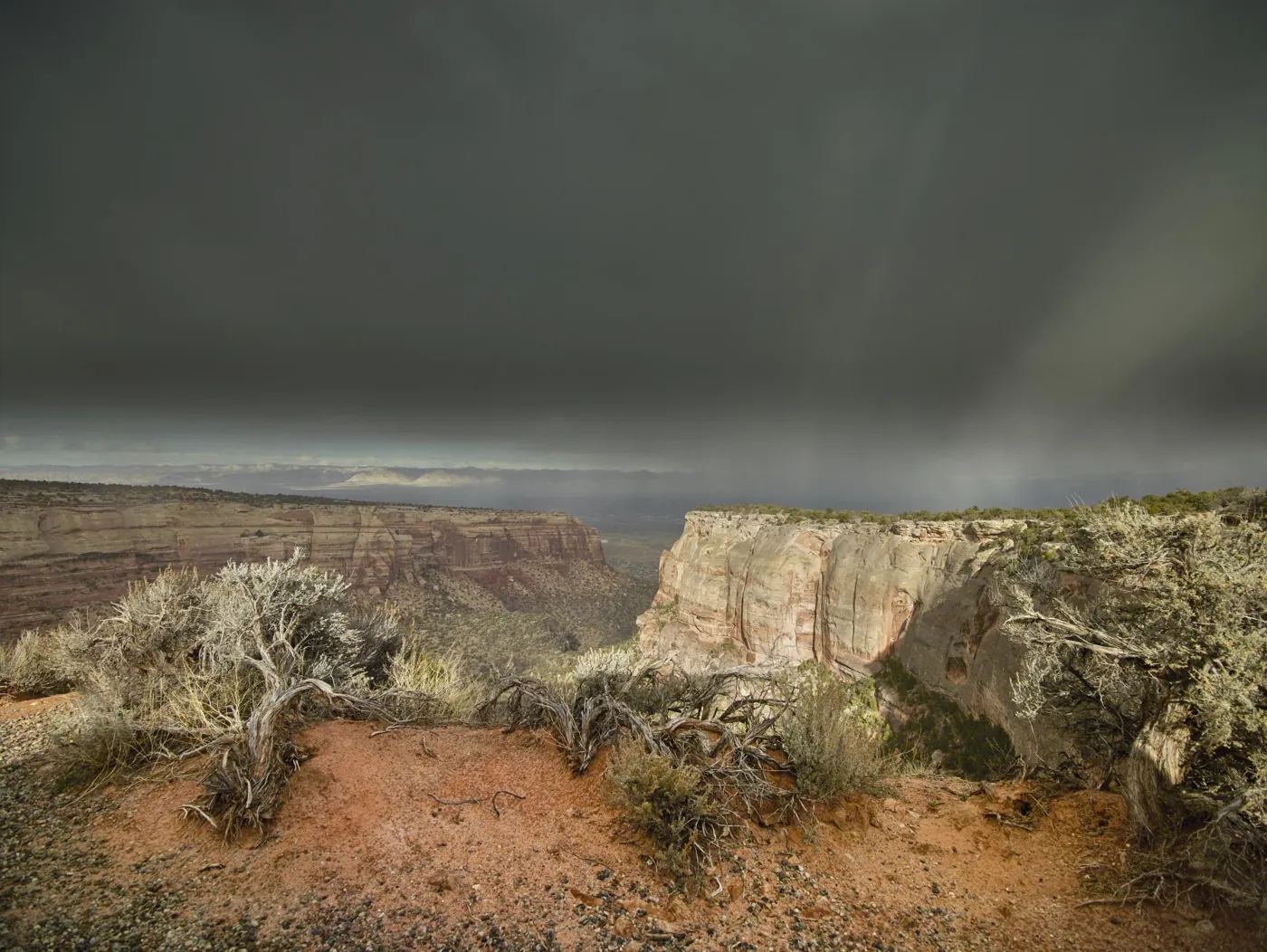
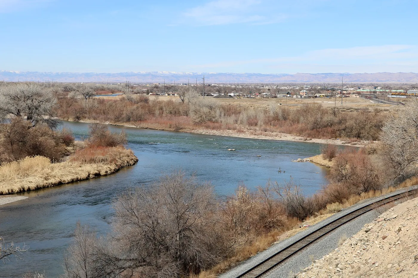
Compare it with the Monument's red-rock sequence: the two landscapes should not be assigned one origin merely because they share a panorama. Then return to the history of Grand Junction, where transportation and water delivery helped turn geography into an urban and agricultural network. The regional story becomes stronger when its parts remain distinct enough to be understood.
The most revealing feature of Grand Mesa may be the reversal hidden in its outline. High ground can preserve the history of a low place. Something that appears fixed can be a remnant of extensive change. And a landscape admired from below can be working within the systems on which life below depends. Knowing those relationships gives the familiar horizon a different kind of depth.
Source notes: Colorado Geological Survey: Mesa Lakes Quadrangle OF-19-08 ↗ · Grand Junction Water Supply ↗
Sources & further reading
Desk-research source notes assembled 2026-10-17. Owner publication approval does not imply independent specialist review. Consult the source directly for current access, hours, fees, and conditions.
- Colorado Geological Survey: Mesa Lakes Quadrangle OF-19-08 ↗
- USGS OFR 2011–1210, Cole: Grand Mesa Basalt Field ↗
- Grand Junction Water Supply ↗
- NASA: Snow Campaign Wraps 2020 Survey ↗
- USGS: Snow Water Equivalent variable ↗
- NASA Technical Reports: Observing Seasonal Snow in a Forested Environment ↗
- NSIDC: SnowEx20 Grand Mesa SWE and Snow Density ↗
- CDOT: Grand Mesa Scenic Byway ↗
Written as a desk-researched guide, without a claim of firsthand reporting. Our editorial standards.
.jpg)