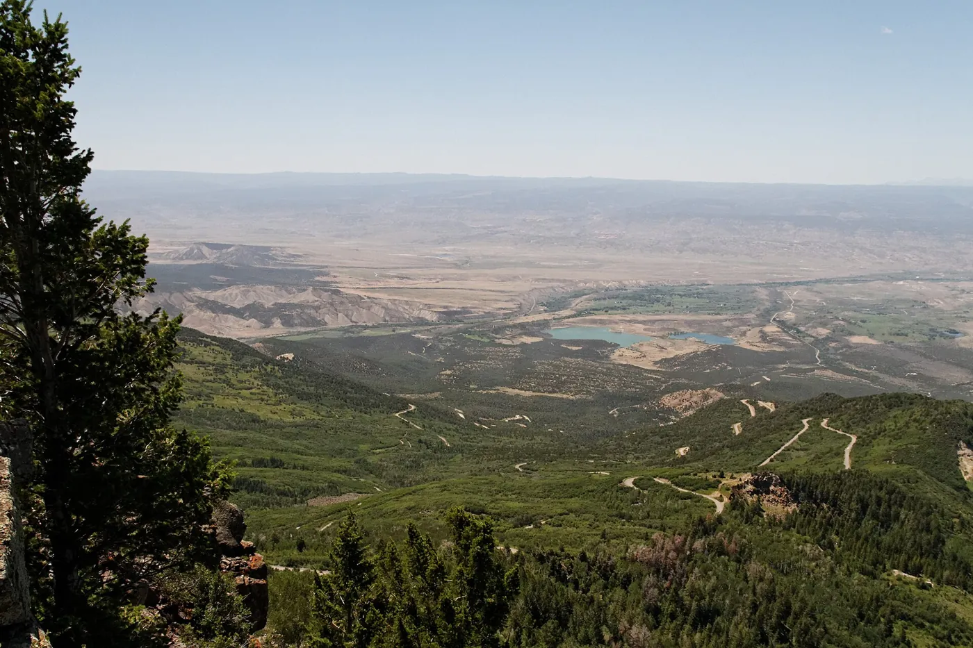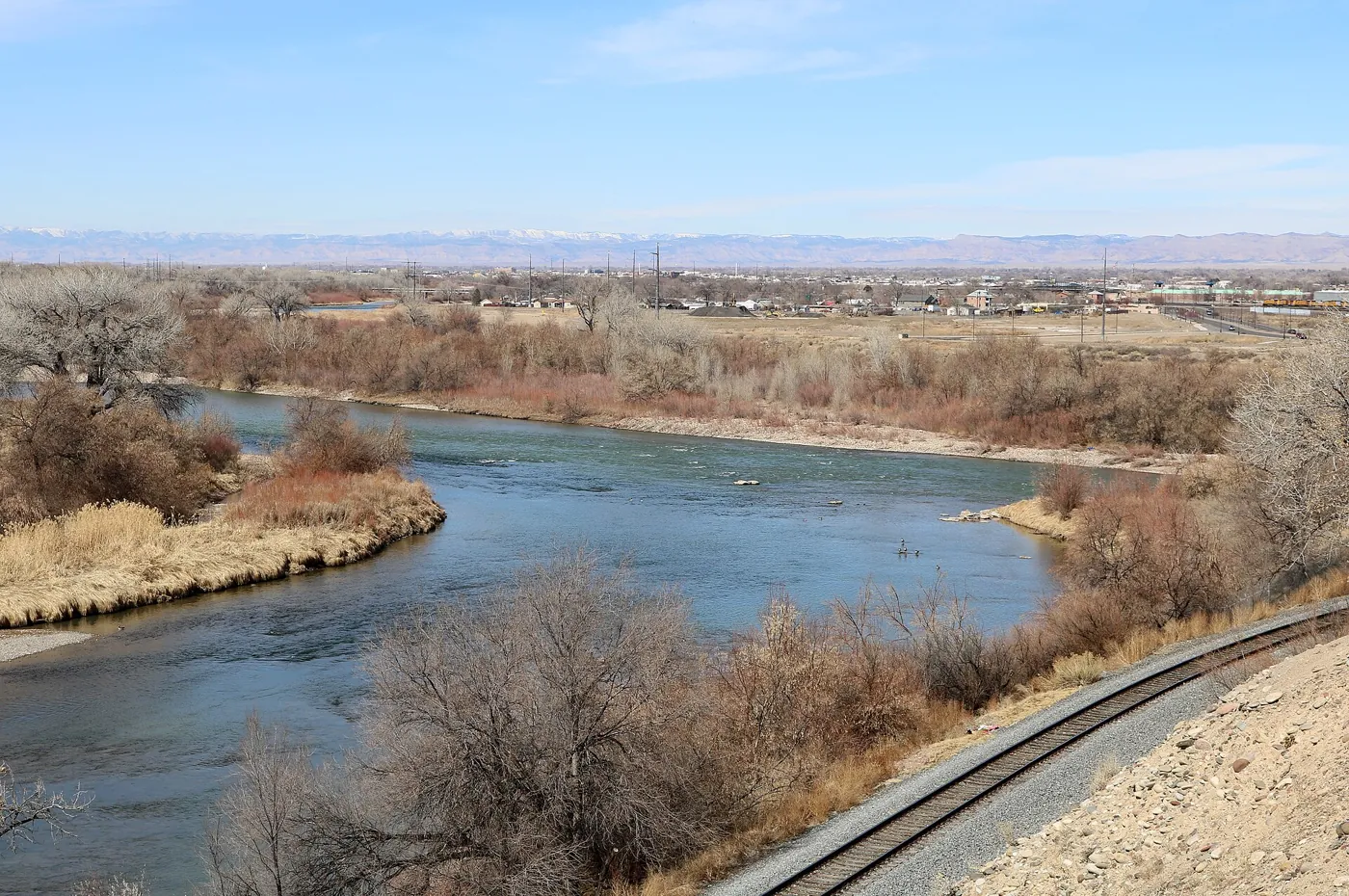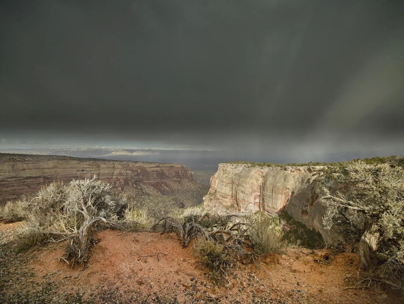
A red cliff invites a deceptively simple question: how old is it? At Colorado National Monument, the answer depends on what you mean. The material in the cliff, the hardening of sediment into rock, the uplift of the landscape, and the excavation of a canyon belong to different episodes. The monument becomes more interesting when those episodes stop competing for a single date. Its landscape is a record of environments that disappeared, evidence that did not survive, and processes still changing the view.
Begin with the distinction between rock and landform
Colorado National Monument stands on the northeastern edge of the Uncompahgre Plateau above the Grand Valley. The National Park Service's geodiversity atlas places it within the broader Colorado Plateau region and describes sedimentary units above older basement rocks. These are nested geographic and geologic relationships. The monument, Uncompahgre Plateau, Grand Mesa, and Book Cliffs are not alternate names for one continuous formation.
Two separate questions organize a visit. What environment produced a layer? What later processes exposed and shaped it? The first concerns the origin of the rock; the second concerns the present landform. A sandstone deposited in an ancient desert can now stand in a canyon whose shape developed much later. Calling the canyon “200 million years old” because a prominent rock is approximately that age merges evidence for different events.
That separation also changes how we use the word history. The view contains a sequence, but it does not contain an uninterrupted record of every event. Some materials accumulated. Others were removed. Some older structures were reworked. A photograph holds the surviving evidence together in one frame; an explanation has to pull its different times apart.
Source notes: NPS Geodiversity Atlas: Colorado National Monument ↗ · NPS: A Brief-ish History of Our Geology ↗
At the bottom, rocks from a different world
The dark rocks exposed in canyon bottoms belong to the Precambrian basement. The park's account places them broadly between about 1.4 and 1.7 billion years old and describes a history involving sedimentary origins, metamorphism, and igneous activity. Metamorphism means that heat and pressure changed rock without simply leaving it in its original state. These rocks are therefore evidence of transformations within the crust, rather than another layer of the desert seen above.
“Basement” is a structural term here, not a claim that these are the first rocks Earth ever had. It identifies the older foundation beneath a younger sedimentary succession in this place. The distinction is important in a landscape where the oldest exposed material and the most visually dramatic cliffs can be close together.
The contrast asks a visitor to resist reading color as time. Dark does not automatically mean old in every landscape, nor red young. The interpretation depends on mapped relationships and geological investigation. What makes the monument legible is the relationship between the units, not a universal color code that can be applied from any overlook.
Source notes: NPS: Precambrian Basement Rocks ↗
The time that did not remain as layers
Between basement and younger sedimentary rock lies a large gap in the local record, commonly described here as part of the Great Unconformity. The NPS gives its scale as roughly 1.5 billion years. That interval is not represented by a complete sequence of layers at the contact. Geological processes continued; the surviving local archive does not preserve them all.
An unconformity can involve erosion, a period without deposition, or both. It is a relationship between rocks that formed at widely separated times. Reading it as an empty interval in Earth's history would be wrong. The gap belongs to the record preserved at this location, not to the existence of events elsewhere.
This is one of the strongest lessons the monument offers a student: adjacent evidence need not describe consecutive moments. A boundary can contain a greater span of time than a thick stack above it. The landscape's missing record is not a flaw to fill with a confident imagined scene. It is a reason to compare evidence across locations and acknowledge what an outcrop alone cannot show.
Source notes: NPS: Precambrian Basement Rocks ↗ · NPS Geodiversity Atlas: Colorado National Monument ↗
The Wingate remembers moving sand
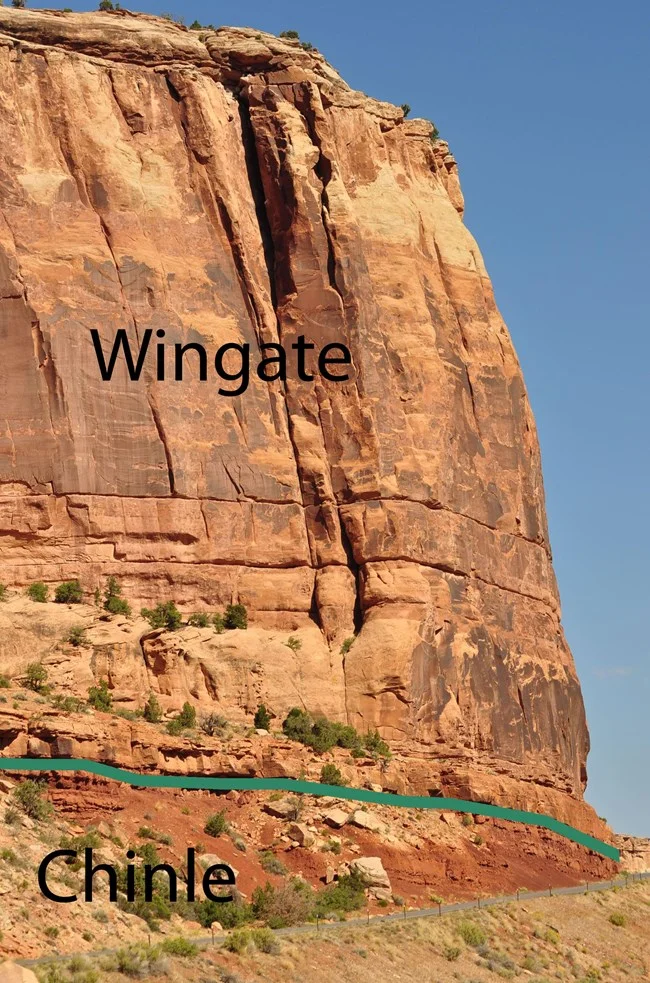
The Wingate Sandstone forms many of the monument's conspicuous cliffs. The park describes it as wind-deposited sandstone, approximately 200 million years old, with cross-bedding that helps reveal the movement of ancient dunes. Cross-beds are inclined layers within the larger rock unit. They preserve the geometry of sediment accumulating as dunes migrated, rather than simply tracing the present slope of the canyon wall.
The useful surprise is a change in material behavior: sand that once moved became rock capable of supporting a sheer face. Deposition alone did not make a cliff. Burial and the processes that bind sediment into rock preceded the later exposure and erosion that produced the familiar view. An ancient environment and a modern shape are connected through that intervening history.
The NPS describes the depositional setting as part of a large dune region. It is reasonable to use that interpretation to understand the formation; it is not reasonable to identify every individual dune from a casual photograph. A good explanation distinguishes the broad environment supported by geological evidence from details a visitor cannot reconstruct independently.
Source notes: NPS: Wingate Sandstone ↗
Why a cliff, a ledge, and a slope differ
The park's rock-layer guide describes softer Chinle material below the Wingate and the Kayenta Formation as a cap on many monoliths. Their contrasting resistance helps explain why a sequence can produce a slope below a cliff and a ledge above it. The layers participate differently in the retreat of the canyon wall.
This is differential erosion: neighboring materials do not necessarily wear away at the same rate or in the same way. Removing support beneath stronger rock can contribute to failure above. A tower can survive after surrounding material has retreated without having been separately built as a tower in the first place.
Such an explanation is more useful than a claim that “the river carved everything.” The Colorado River belongs to the regional drainage story, but the monument's side canyons also involve local runoff, weathering, and the movement of material down slopes. The large river's importance does not mean it once occupied the position of every present canyon wall. Scale matters when connecting regional drainage to a particular feature.
Source notes: NPS: Rock Layers ↗
Lifting the rocks and lowering the surface
Uplift and erosion describe different kinds of change. Tectonic movement can raise and deform rock, while weathering and erosion break material down and move it away. The geodiversity atlas places the Uncompahgre uplift within a regional history involving more than one episode of movement. The exposed sedimentary succession is not simply an undisturbed pile lifted once and then left alone.
Nor is erosion an activity reserved for a vanished geological past. The park's process account describes runoff carrying debris, water entering cracks, and freeze-thaw action widening them. Where freezing occurs, the expansion of water can help open fractures. Gravity then matters in the movement of loosened rock. These mechanisms operate together; their effects depend on material, exposure, and conditions.
The resulting view is temporary on the scale of landscape history. That does not justify predicting the date of a particular rockfall. It means the familiar outline of a cliff is a stage in an ongoing process. An explanation can describe the mechanism without pretending to forecast the next event at a named overlook.
Source notes: NPS Geodiversity Atlas: Colorado National Monument ↗ · NPS: A Brief-ish History of Our Geology ↗
Why geological numbers should be read carefully
The NPS's interpretive rock-layer page uses rounded ages. Its more detailed atlas offers a fuller stratigraphic discussion, including disagreement about how some strata should be assigned and named. Those differences are reasons to preserve context, not reasons to select whichever number or label sounds most precise.
A formation is a defined body of rock, not a single instant. Different samples, methods, regional correlations, and levels of explanation can produce different age expressions. A rounded visitor-facing date may be appropriate for orientation without becoming the exact age of every part of a formation. The same care applies when comparing descriptions written for different parks.
For a first reading, the robust relationships are sufficient: older basement below, a substantial missing interval, younger sedimentary environments above, and later deformation and erosion. Specialist questions require the relevant maps and literature. Precision is valuable when the evidence supports it; extra digits or a categorical label can be misleading when they conceal the scale and limits of a claim.
Source notes: NPS Geodiversity Atlas: Colorado National Monument ↗ · NPS: Rock Layers ↗
Protection began in 1911; the place did not
The NPS records that President William Howard Taft established Colorado National Monument on May 24, 1911, following advocacy by John Otto and other supporters. Otto became its first superintendent. Those facts explain a chapter in federal protection and public access. They do not mark the beginning of human knowledge of the landscape.
The park identifies continuing cultural ties with the Ute Indian Tribe of the Uintah and Ouray Reservation, Ute Mountain Ute Tribe, Southern Ute Indian Tribe, White Mesa Ute Community, and Navajo Nation. These are living communities. Their relationships with the place cannot be reduced to an anonymous “ancient people” paragraph, and an agency summary does not replace their own accounts.
The designation is also specific: this is Colorado National Monument, a unit administered by the National Park Service. Calling it Colorado National Park changes its name and designation. The ordinary word “park” may describe an NPS-managed place, but an editorial guide should keep the proper title clear. The distinction prevents a familiar landscape from becoming an inaccurate destination in someone's research.
Source notes: NPS: John Otto ↗ · NPS: Traditionally Associated Tribes ↗
The road is part of the history being viewed
Rim Rock Drive makes a broad canyon-rim perspective accessible by road. Its construction was a sustained public-work project, not an effortless accompaniment to the scenery. The NPS timeline records preliminary work in 1931, major New Deal involvement, and completion in 1950. The park's New Deal account identifies CCC, WPA, and FERA workers alongside local experience and skills.
The timeline also records that blasting at Half-Tunnel killed nine local men on December 12, 1933. That loss belongs in the history of the view. A road cut and a masonry wall express labor and risk as well as design. Recognizing this does not diminish the landscape; it makes the means of accessing it visible.
The historic timeline gives a completion length of 22.42 miles, while today's visitor guidance describes a 23-mile drive. Those are different levels of precision in different contexts, not a reason to invent a newly discovered route. For present travel planning, use the current agency guidance. For the road's construction history, preserve the dates, phases, and human costs that a rounded mileage cannot communicate.
Source notes: NPS: Rim Rock Drive Timeline ↗ · NPS: New Deal ↗
A modern visitor center changes how a landscape is encountered
Protection is not the same as leaving a place without buildings. At Saddlehorn, the NPS describes a visitor center designed by Cecil Doty as part of Mission 66, the postwar effort to improve visitor facilities. The building joined exhibits and public services with administrative functions. Its windows, porches, and materials made an architectural argument about how people should encounter the landscape.
That is a different historical layer from the earlier rustic work. A visitor can move through a natural setting while also moving through decisions about roads, interpretation, architecture, staffing, and access. A building does not stand outside the landscape story simply because its materials are modern.
This helps explain why the monument's relationship with surrounding communities is more than a view from town. Advocacy, employment, construction, travel, education, and maintenance connect the protected unit to the Grand Valley. Those connections can be studied without presenting local institutions as Boxcar partners or implying that citation creates an endorsement.
Source notes: NPS: Mission 66 at Colorado National Monument ↗
Life occupies the spaces between the rocks
The monument is not a geological exhibit with the living world removed. Its pinyon-juniper woodland, biological soil crusts, and rain-filled sandstone basins connect physical conditions with ecological life. The NPS describes soil crusts as communities of small organisms that help hold soil particles together. Apparently bare ground can therefore be a living surface rather than an empty place to step.
The park also describes potholes—natural basins that collect rainfall and sediment—as habitat for organisms adapted to intermittent water. Their small scale makes them easy to overlook beside a canyon, yet they illustrate the same broader lesson: the shape and properties of rock influence where water and life can persist.
This knowledge changes conduct as well as interpretation. Staying on established trails helps protect soil communities; leaving rain-filled basins undisturbed protects small habitats. The advice follows directly from understanding what is present. It is more meaningful than a generic instruction to respect nature, because it explains why a seemingly minor disturbance can matter.
Source notes: NPS: Natural Features & Ecosystems ↗
Looking out, looking back
The NPS describes Rim Rock Drive as a 23-mile paved route and identifies the Fruita entrance as closest to the visitor center. Those facts help orient a visit, but they do not guarantee current road access, weather, or services. Consult the agency's current conditions before setting out. This feature is an explanation of place, not a live road report.
At an overlook, try a sequence of observations rather than a checklist of attractions. Separate a layer from a landform. Look for the relationship between slope, cliff, and cap. Consider how the exposed rocks differ from the valley and skyline beyond. Then notice the road, walls, and buildings that make the vantage point possible. Natural and human histories can occupy the same view without operating on the same clock.
The companion drafts on Grand Junction's development and Grand Mesa's geological and water history continue that reading across the valley. The Monument's sandstone and Grand Mesa's basalt are different materials with different histories. Seeing the distinction makes the regional panorama more interesting, not less unified.
The red rocks reward more than admiration. They teach a way of asking questions: what survives, what is missing, which process a claim describes, and whose history an appealing view might conceal. Once those questions become part of looking, the landscape offers more than a photograph can hold.
Source notes: NPS: Getting Around ↗
Sources & further reading
Desk-research source notes assembled 2026-10-17. Owner publication approval does not imply independent specialist review. Consult the source directly for current access, hours, fees, and conditions.
- NPS Geodiversity Atlas: Colorado National Monument ↗
- NPS: A Brief-ish History of Our Geology ↗
- NPS: Precambrian Basement Rocks ↗
- NPS: Wingate Sandstone ↗
- NPS: Rock Layers ↗
- NPS: John Otto ↗
- NPS: Traditionally Associated Tribes ↗
- NPS: Rim Rock Drive Timeline ↗
- NPS: New Deal ↗
- NPS: Mission 66 at Colorado National Monument ↗
- NPS: Natural Features & Ecosystems ↗
- NPS: Getting Around ↗
Written as a desk-researched guide, without a claim of firsthand reporting. Our editorial standards.