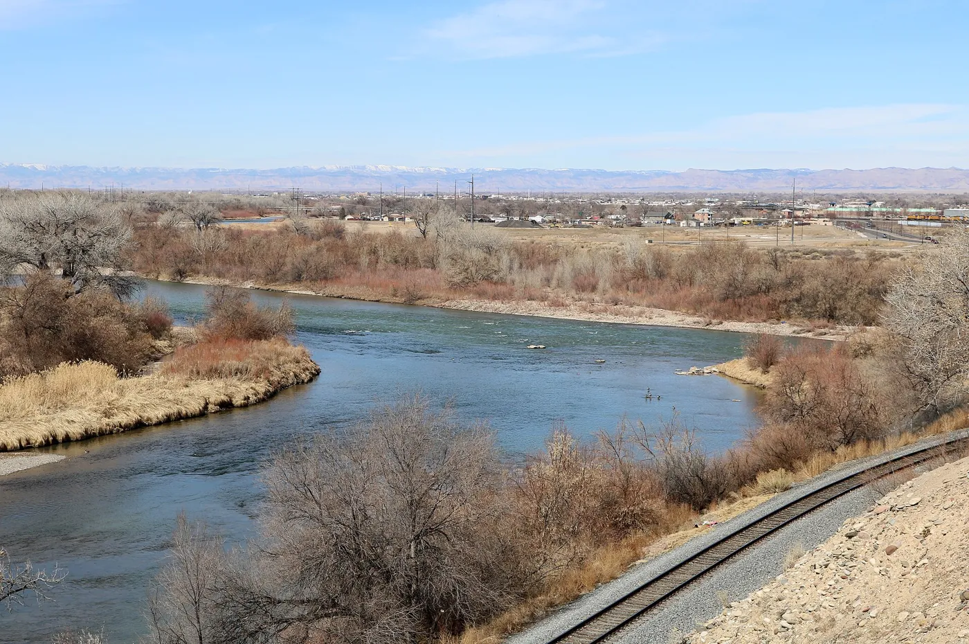
Grand Junction's name sounds like an explanation: two rivers meet, and a city follows. The Colorado and Gunnison do meet here. But a confluence alone does not lay out streets, fund a railroad, dig a canal, or decide who is permitted to hold land. The city's history emerges from the interaction of geography with power, engineering, investment, and work. Reading those connections makes the Grand Valley more intelligible—and makes a simple founding story harder to accept.
A meeting place is an opportunity, not a destiny
A river junction brings different routes into the same landscape. In the Grand Valley, the Colorado approaches through the regional river system and the Gunnison joins it from the southeast. That meeting helps explain the city's name and its position within a larger geography of movement. It does not, by itself, explain the municipality established in the nineteenth century. Plenty of confluences never become cities. The more revealing question is how people converted this particular location into a network that could sustain one.
The word “Grand” preserves an older layer of that geography. The river now called the Colorado was formerly the Grand along its upper reach. A congressional resolution approved in 1921 changed the public-record name of the river from its source to its meeting with the Green in Utah. Grand Junction kept its name. Reading an older map therefore requires translating between different names for the same river, rather than imagining a second watercourse that disappeared.
Names help orient us, but they can also narrow the story. The name of a settler municipality cannot stand for all the ways a landscape was known before the town existed.
Source notes: Bureau of Reclamation: Grand Valley Project ↗ · United States Statutes at Large: Grand River name resolution ↗
Before there was a townsite
The Southern Ute Indian Tribe's historical account identifies the Uncompahgre, or Tabeguache, with areas near the Uncompahgre, Gunnison, and Elk rivers, including the vicinity of present-day Montrose and Grand Junction. Its account of seasonal movement describes Tabeguache winter camps near those cities. This is a picture of an inhabited region connected through movement, relationships, and knowledge. The absence of a modern municipal boundary did not mean the absence of people or an organized relationship with the land.
Seasonal movement is especially easy to misread through a town-centered lens. A community does not have to remain on one street grid throughout the year for its use of a region to be consequential. Different elevations, seasons, and resources made movement part of living here. The modern separation of mountain destination, agricultural valley, and city neighborhood is not the only possible way to understand the region.
That perspective changes the question posed by “Why Grand Junction exists.” The question concerns the rise of a particular city. It must not imply that history began when that city acquired a name.
Source notes: Southern Ute Indian Tribe: History ↗ · Southern Ute Indian Tribe: Chronology ↗
The violence inside a founding date
The Southern Ute chronology records the removal of the Tabeguache and White River Utes to Utah in 1881. The city's preservation history also places Grand Junction's establishment after Ute removal that year, though its brief account uses the softer language of relocation. These sources describe related events from different institutional positions. Replacing removal with a neutral-sounding transition would obscure the coercion that made settler access possible.
The proximity of these events matters more than a picturesque pioneer scene. A townsite was not simply an answer to vacant land and promising weather. Its formation followed a transfer of control that was profoundly unequal. Geography made some activities possible; government policy and dispossession shaped who could pursue them, under what authority, and at whose expense.
The removal of particular groups must not become a claim that all Ute people left Colorado, or that Indigenous connections ended. Historical bands and present sovereign nations are related subjects, not interchangeable labels. A city history needs both an account of dispossession and recognition of living communities. Neither is adequately handled by a ceremonial sentence before the “real” story starts.
Source notes: Southern Ute Indian Tribe: Chronology ↗ · Grand Junction Historic Preservation Board ↗
What happened in 1881—and what happened in 1882
Grand Junction's charter distinguishes several acts that popular histories can compress into one founding moment. It records a townsite in 1881 and the incorporation of the Grand Junction Town Company in the same year. It separately records municipal incorporation in 1882. A company organizing a townsite and residents forming a municipality are different institutional events, even when they occur within a short interval.
That distinction is useful because it restores decision-making to the landscape. A townsite implies surveys, parcels, and an expectation that a place can attract people and capital. Municipal incorporation concerns a governing arrangement. Neither event can be inferred from a river junction alone. They mark steps in turning a geographic location into property, streets, institutions, and a civic identity.
The charter is valuable evidence for how the city records its own history, but even an official page should not be treated as beyond checking. Different dates can refer to different milestones; apparent discrepancies need investigation before being resolved into a neat anniversary. For this regional overview, the supported sequence is more important than choosing a single ceremonial day.
Source notes: Grand Junction Charter, Article XVIII: Official Data ↗
A railroad town required more than rails
The National Register nomination for Grand Junction's Denver and Rio Grande Western depot documents town-company negotiations with the railroad, a first locomotive arrival in 1882, and the acquisition of land for a repair facility and switchyard. The precise first-train day varies between historical accounts and warrants corroboration with contemporary records before a detailed anniversary feature; it is not necessary to understanding the larger change.
The distinction is between a line passing through a place and an operating center located there. The nomination connects railroad facilities with employment and community development. A railroad system needed people and facilities as well as track. That gave a young town an economic function within a much larger network, rather than merely a faster route to somewhere else.
Transport also altered the meaning of distance. Local production becomes a different proposition when goods can enter wider markets. Rail access did not guarantee prosperity, and it did not eliminate the work or costs of production. It helped create the conditions under which farming, trade, employment, and urban services could reinforce one another. The railway belonged in the city's causal history, rather than as an isolated milestone beside a photograph of a locomotive.
Source notes: National Register nomination: Denver and Rio Grande Western Railroad Depot, Grand Junction ↗
A river nearby was not water in a field
For farming, the important distinction was between the presence of water and the capacity to deliver it. Reclamation's Grand Valley history describes ditch building soon after settlers arrived in 1881 and the completion of the Grand Valley Canal in 1886. It also distinguishes that earlier canal from the later federal Grand Valley Project. Those systems should not be collapsed into a single construction effort.
A canal makes a physical argument about the landscape. Its intake, elevation, route, and capacity determine where water can go. Land beside a river and land reachable by a canal are not identical categories. Reclamation's account describes unsuccessful private efforts to reach higher lands before federal involvement. The obstacles were technical and financial, not simply a shortage of enthusiasm.
This is one reason an aerial view of the valley can mislead. Green fields look like a natural property of the place when seen at a distance. In historical terms they also express infrastructure, investment, maintenance, and organized distribution. The difference between valley floor and higher ground helped shape what could be cultivated and what additional works would be needed.
Source notes: Bureau of Reclamation: Grand Valley Project ↗
Building a connected agricultural landscape
Reclamation dates the construction of the Grand Valley Project's diversion dam and Government Highline Canal to 1912–1917. Its description places the diversion above the confluence with Plateau Creek and traces water through a regional canal network. The works made the agricultural geography something larger than individual farmers acting independently beside a river.
The engineering relationship is straightforward; the social consequences are more extensive. A field reached through shared infrastructure depends on work beyond its own boundary. A diversion must operate, a canal must carry water, and the system must be maintained across the distance separating intake from use. An orchard's visible rows are only the most conspicuous part of that relationship.
The federal works were later than the town's founding and the arrival of rail. That sequence prevents a common historical shortcut: the mature irrigated landscape cannot be projected backward as if it were already waiting in 1881. The system developed through successive projects. Transportation, cultivation, and town growth interacted over time rather than appearing together in a single moment of discovery.
Source notes: Bureau of Reclamation: Grand Valley fish passage environmental assessment ↗
Water for a city is a related, different story
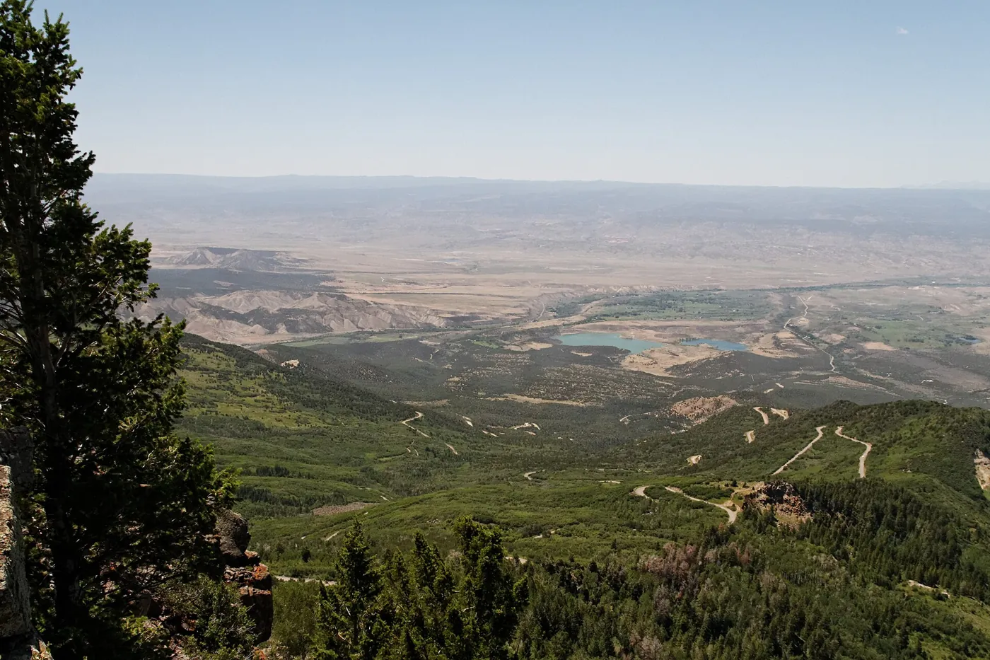
Grand Junction's municipal water supply adds another direction to the map. The city's Water Services description identifies reservoirs on Grand Mesa, raw-water flowlines, and stream and ditch structures, and records ongoing snow surveys on the mesa. The view toward high ground is therefore also a view toward infrastructure serving the city. Grand Mesa is more than a distant recreational backdrop.
This does not mean every Grand Valley household receives water from the same source or provider. A statement about the city-operated system has a defined scope. Irrigation canals, municipal treatment, mountain storage, and household distribution are connected questions, but their boundaries and responsibilities differ.
Understanding that distinction helps residents read a familiar landscape with more precision. A broad river can be important to the region without being the direct source of every tap. A mountain reservoir can matter to urban life without explaining every agricultural field. A useful local history follows the actual connections instead of assigning one source to everything green or growing.
Source notes: Grand Junction Water Supply ↗
Prosperity arrived in cycles
The city's preservation history identifies agricultural crises, the Great Depression, the growth and decline of uranium activity, and the departure of oil-shale companies among the forces that shaped Grand Junction. That summary challenges a simple account of uninterrupted progress from townsite to regional center. A connected city could attract opportunities and also experience disruptions originating beyond its streets.
The built environment holds some of those histories unevenly. The city points to the railroad depot, Avalon Theater, St. Regis Hotel, and North Seventh Street Historic District as preserved examples. These are useful starting points for research, not proof that every period or community is represented equally in surviving architecture. A grand building may be well documented while the labor that sustained it is harder to find.
Preservation invites a second kind of reading. Ask what a structure was for, who used it, who paid for it, and what conditions enabled it to survive. Those questions produce a richer city history than treating each facade as an attractive remnant of an undifferentiated past. Present access and private ownership must be checked separately; historical importance is not an invitation to enter a building.
Source notes: Grand Junction Historic Preservation Board ↗
Infrastructure carries responsibilities downstream
Reclamation's environmental assessment for the Grand Valley diversion describes fish passage at the dam and a fish screen in the Government Highline Canal. The document makes a different set of river connections visible: irrigation works can affect movement and habitat for organisms as well as delivery to farms. Its purpose was to assess proposed measures, not to certify every present-day ecological outcome.
This belongs in a history of development because infrastructure continues to have consequences after construction ends. A canal is not finished history merely because its opening date has passed. Operation, environmental review, adaptation, and maintenance shape its later life. The same works can be agricultural assets and places where ecological responsibilities have to be addressed.
A mature account can recognize the skill and work involved in making the valley productive while also asking about the costs of that transformation. Those questions do not cancel one another. They make the subject more useful to people who depend on the region today.
Source notes: Bureau of Reclamation: Grand Valley fish passage environmental assessment ↗
The city as a set of relationships
Grand Junction exists where a geographic meeting became an engineered and governed network. Rivers help explain its location; rail helped give it a role beyond the valley; irrigation changed the reach of cultivation; municipal systems connected high country to urban life. None of those relationships removes the history of dispossession that preceded the townsite, or the continuing significance of the land to Indigenous peoples.
Read the region at more than one scale. At the confluence, consider why routes meet. Near a canal, consider the difference between water's presence and its delivery. In town, consider how institutions and markets shaped the streets. Looking toward Grand Mesa, consider where water is stored and how its seasonal movement connects different elevations.
The river-name resolution offers a final reminder that public language and physical geography move on different clocks. A river can receive a new official name while old names persist in towns, documents, and memory. Likewise, a city's founding can be precisely recorded without exhausting the history of its place.
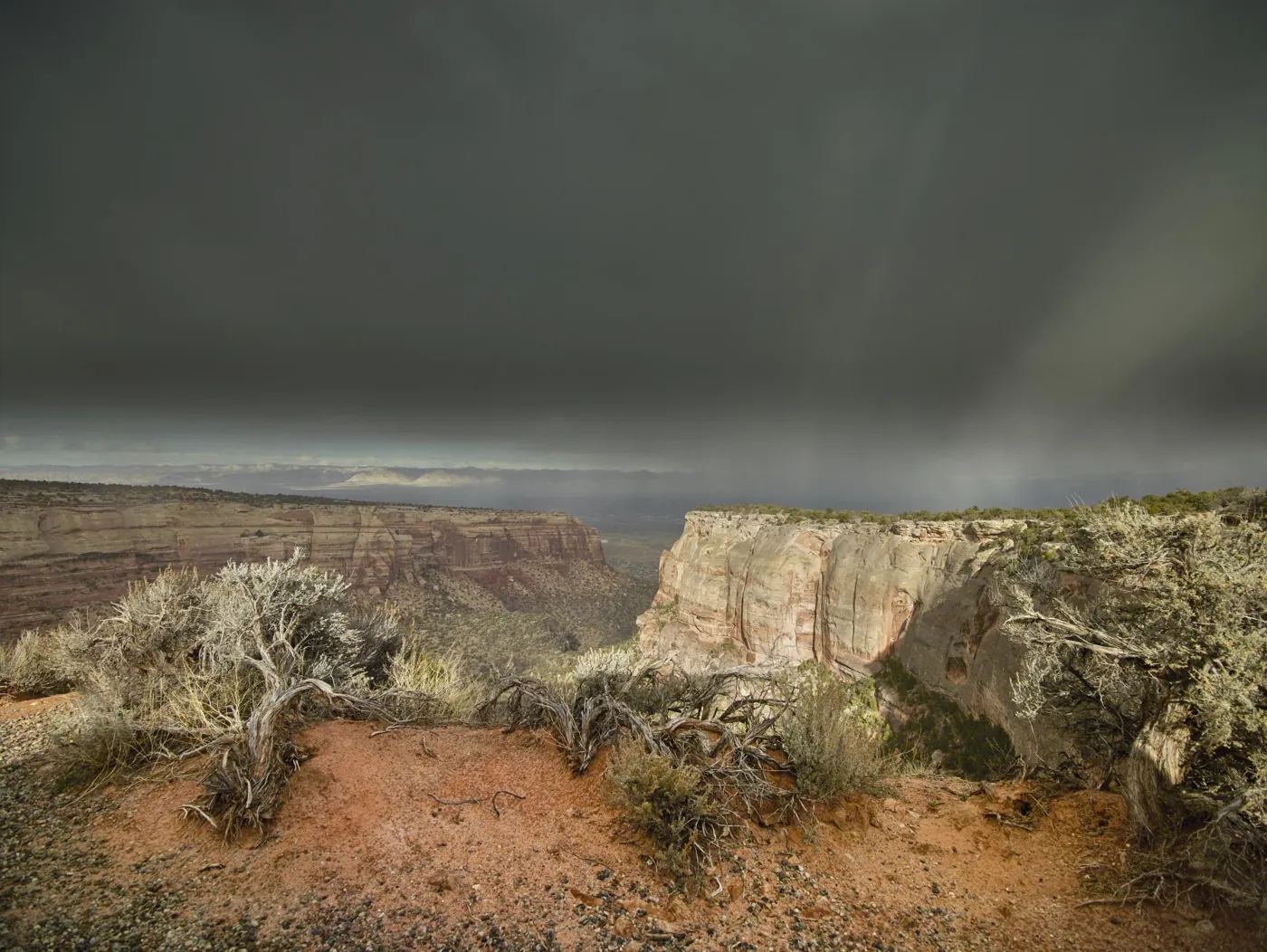
The next layer is the landscape beneath these connections. Our companion drafts on Colorado National Monument and Grand Mesa follow the rocks and watersheds that help frame the valley. They belong to the same regional story, though neither can substitute for listening to the people who continue to make their lives here.
Source notes: Southern Ute Indian Tribe: History ↗ · United States Statutes at Large: Grand River name resolution ↗ · Grand Junction Water Supply ↗
Sources & further reading
Desk-research source notes assembled 2026-10-17. Owner publication approval does not imply independent specialist review. Consult the source directly for current access, hours, fees, and conditions.
- Bureau of Reclamation: Grand Valley Project ↗
- United States Statutes at Large: Grand River name resolution ↗
- Southern Ute Indian Tribe: History ↗
- Southern Ute Indian Tribe: Chronology ↗
- Grand Junction Historic Preservation Board ↗
- Grand Junction Charter, Article XVIII: Official Data ↗
- National Register nomination: Denver and Rio Grande Western Railroad Depot, Grand Junction ↗
- Bureau of Reclamation: Grand Valley fish passage environmental assessment ↗
- Grand Junction Water Supply ↗
Written as a desk-researched guide, without a claim of firsthand reporting. Our editorial standards.